|
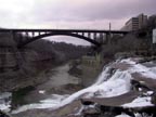
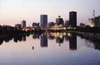
You
can see the rapids above downtown from the Court
St. bridge. You can probably find a parking spot
on the bridge. South of the bridge is a dam
with a fall of about 15 feet north of the Court
St. bridge you can see the rapids, the downtown
skyline, and the Broad Street bridge.
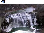
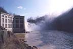
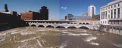
View
the Upper Falls (High Falls) from the Pont du
Rennes (formerly the Platt St. bridge) which
is a pedestrian only bridge. Don't miss the overlook
on the east side upstream from the bridge which
has the best view. Also, be sure to visit the Brown's
Race area on the west side for a close-up view of
the crest and the remains of the water-powered era
of Rochester's industrial past.
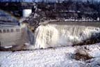
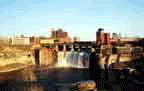
There
is no easy access to the Middle Falls, and for most
of the year the water is diverted to an RG&E
generator. You may be able to catch a glimpse of
the Middle Falls from the east end of the Driving
Park Bridge or from the newly opened (2001) Lower
Falls Park.
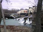
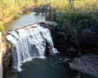
You
can see the Lower Falls from the Driving Park bridge.
For a closer look, there is a short, improved trail
from Maplewood Park to an overlook, and the Lower
Falls Park on the south side of Driving Park. You
can also find an access road off of Seth Green near
St. Paul Blvd. on which you can take a short hike
down to the bottom of the gorge. |