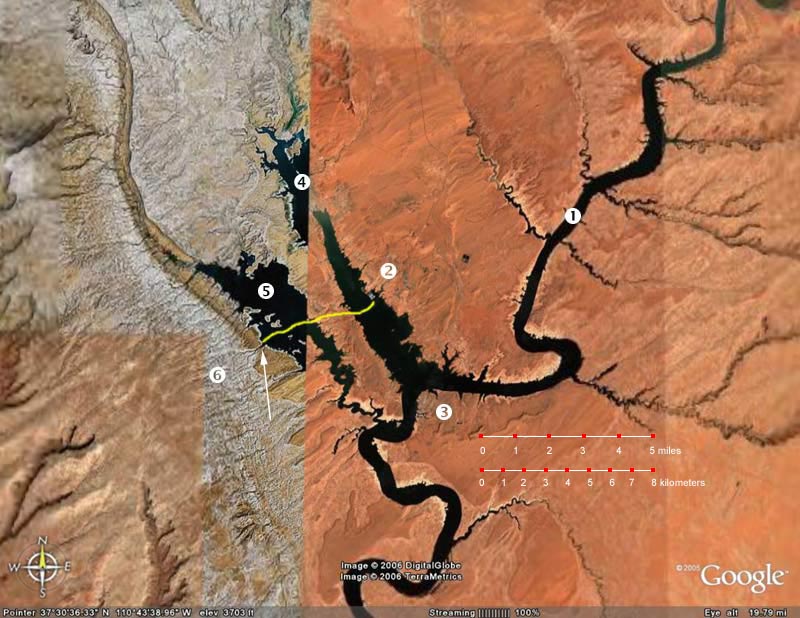
The white arrow points to our 1999 camping spot. The motorboat that dropped us off went pretty much in an east to west line (Yellow line) from Bullfrog, about 3.5 miles. Today, it looks like a 10 mile boat trip and a one mile hike. |
A small part of Lake Powell from Google Maps. When we first saw this map, we thought that the older, low-resolution photo on the left and the more recent high-resolution photo on the right were not aligned correctly. But on closer inspection, you can see that the reduced water level has dramatically changed the shoreline of the lake. The level in October, 2006 is 3600 feet, one hundred feet below the "full pool" level attained in 1980. The white arrow shows where we camped in 1999 and we estimate that the left side of the photo was from that time. The right side is recent, we estimate 2005. You can explore this further at Google Maps. If you have installed Google Earth, you can try this KMZ file. |