Menteth Roadside Falls
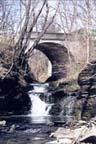
Deuel Rd. Bridge Falls
 |
| Location |
A tributary of Canadaigua lake in Ontario county. |
|
Access
Map
|
Private
We've
gone in from the Deuel Rd. bridge off of Route
21 just south of Cheshire and from W. Lake Rd at
Menteth
Point.
You can see the "Roadside Falls" from
Route 21 just south of Deuel Rd.
|
| Hiking |
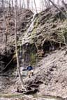
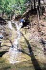
Easy to Moderate. We've walked upstream a short distance from W. Lake Rd.
to the lower main falls, but didn't feel like scrambling around the falls on private
property although it looked technically doable. We've also hiked down the gully from the
Deuel Rd. bridge to the crest of the main falls, and then returned to Deuel Rd. by
crossing private land on a farm lane (4 miles round trip). |
| Details |
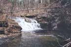
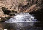
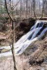
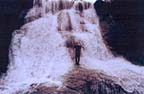
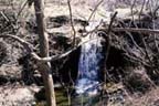
This is a pretty gully with a good sized stream. We counted four
waterfalls on the main stream and four small waterfalls entering from the side. Of the
four tributary waterfalls, three are shown as perennial streams on the USGS map. There is
a northern branch which we estimated to be about 2/3 of the flow of the southern branch
which flows through the village of Cheshire and enters about 1/4 mile below the Duell Rd.
Bridge. We didn't explore this branch for waterfalls. |
|